 FLYMASTER
Waters
Read the water before you go.
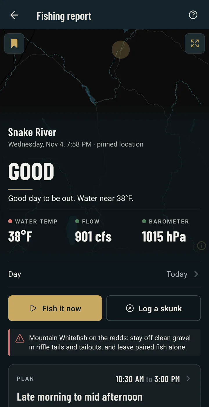
Pick a river or a lake and FlyMaster gathers what the public data says about it today, then turns it into a plan for the day. Your own catches there weigh more than any rule. The same reading, for 407 rivers and lakes in 46 states, is below: find your water.
Conditions
The gauge, the snow, the sky.
The nearest USGS gauge with its flow and thirty days of context. The snowpack at the SNOTEL stations above it against the median. The forecast, the barometer trend, sunrise and sunset, the moon. All of it read on the hour, cached for the drive.
The plan
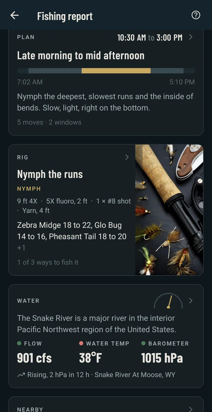
Where to stand, when, what to throw.
A rules engine reads the conditions the way a guide would and writes the day in steps: the hours, the water to fish, the rig and the patterns in their sizes. On the plan, AI assist sharpens it into a written plan and a hatch guide for this place and date, with your own log on the water in hand.
The map
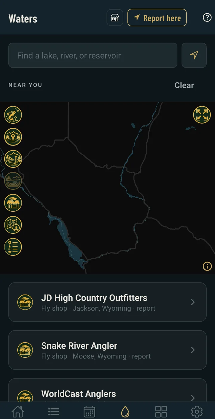
Waters, access and shops, offline.
Named waters and live gauges around you, public land and access points in forty-six states, your own spots, and the fly shops on each water with their reports. Save a map area and it works with no signal.
Find your water
407 rivers and lakes, 390 of them with a live USGS gauge. Each page has today's flow and the last 30 days, the snowpack that feeds it, what is on the water this month, and the fly shops that know it.
- Alabama1 water, 1 gauged
- Alaska14 waters, 7 gauged
- Arizona1 water, 1 gauged
- Arkansas4 waters, 4 gauged
- California15 waters, 15 gauged
- Colorado33 waters, 33 gauged
- Connecticut2 waters, 2 gauged
- Delaware3 waters, 3 gauged
- Florida9 waters, 9 gauged
- Georgia6 waters, 6 gauged
- Idaho14 waters, 14 gauged
- Illinois4 waters, 4 gauged
- Indiana3 waters, 3 gauged
- Iowa2 waters, 2 gauged
- Kansas1 water, 1 gauged
- Kentucky3 waters, 3 gauged
- Louisiana2 waters, 1 gauged
- Maine13 waters, 13 gauged
- Maryland3 waters, 3 gauged
- Massachusetts10 waters, 10 gauged
- Michigan10 waters, 10 gauged
- Minnesota4 waters, 4 gauged
- Missouri6 waters, 6 gauged
- Montana17 waters, 15 gauged
- Nevada5 waters, 5 gauged
- New Hampshire8 waters, 8 gauged
- New Jersey10 waters, 10 gauged
- New Mexico8 waters, 8 gauged
- New York17 waters, 17 gauged
- North Carolina16 waters, 14 gauged
- Ohio13 waters, 13 gauged
- Oklahoma1 water, 1 gauged
- Oregon16 waters, 15 gauged
- Pennsylvania27 waters, 27 gauged
- Rhode Island2 waters, 2 gauged
- South Carolina7 waters, 6 gauged
- South Dakota4 waters, 3 gauged
- Tennessee12 waters, 12 gauged
- Texas12 waters, 11 gauged
- Utah10 waters, 10 gauged
- Vermont6 waters, 6 gauged
- Virginia14 waters, 14 gauged
- Washington16 waters, 16 gauged
- West Virginia3 waters, 3 gauged
- Wisconsin10 waters, 10 gauged
- Wyoming10 waters, 9 gauged
Missing yours? Suggest a water and it is on the list the next night.
Today's plan, the flies, and your own log here.